Leica Geosystems Company Profile
Leica Geosystems has over two hundred years of experience in designing, manufacturing and supplying a wide range of equipment and services that enable professionals to capture, model, analyse, visualise and present spatial information. Leica Geosystems is a global enterprise with more than 2400 employees serving customers in some 120 countries. A highly educated, talented team spans the globe, dedicated to customer success and committed to excellence. From education and training, through ongoing support, and assistance around the clock and around the globe, Leica Geosystems and its partners guarantee productivity and performance.
Leica Geosystems’ solutions encompass a workflow that transforms raw data into meaningful information, turning measurements into maps and maps into models to capture the world. With the broadest range of competencies within the surveying, civil engineering and construction industries, Leica Geosystems delivers a comprehensive range of products that work together in a complete, end to-end workflow. These include GPS and TPS total stations, 3D laser scanning, levels, construction site lasers, hand-held laser distance meters, machine guidance systems, Britain’s first commercial RTK network as well as comprehensive, integrated software solutions. The resulting comprehensive portfolio of products and services, coupled with a dedication to customer service and support, generates innovative solutions that open up new opportunities for their customers’ growth.
Services
Leica Geosystems products are backed up with a comprehensive range of customer services and support. The Active Customer Care program has packages to suit individual requirements for all clients whether they are using a simple measuring device or the most sophisticated integrated solution. Other services include the hire and leasing of equipment, technical support, training courses, after sales servicing, extended warranties and second hand equipment sales.
Products
Leica Geosystems solutions allow our customers to capture raw data and turn it into meaningful and easy to understand information. From a single point, to over 1 million points a second there are a range of instruments and software packages available to suit any measurement need to enable our clients to work more efficiently and productively than ever before.
The product range includes:
Construction Lasers
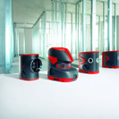
The construction laser range can be used for numerous applications such as general construction, pipe laying, machine control and interior applications for walls and ceilings. Every laser is designed to handle the most demanding construction environment. Options include general construction lasers, interior lasers, grade lasers, line and dot lasers, pipe lasers and laser detectors.
GIS Solutions
For anyone who requires accurate and reliable positioning data, the Leica Zeno delivers consistent sub-metre accuracy both in real-time and via post-processing, that combines the familiar ArcPad software. Manage your assets, respond to emergencies and conduct as-built and incident mapping with the power of GNSS, within a small, rugged, mobile handheld GIS device.
Total Stations & GNSS Solutions
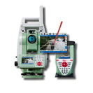
Leica Geosystems provides a range of total stations and GNSS solutions which allows novices and professionals to carry out their measurement jobs effectively and efficiently. The cost effective and tough total solutions provide reliable angle and distance measurements and are available in building and construction, construction and surveying, surveying and engineering and engineering and monitoring options.
High Definition SurveyingTM
Offering both pulsed and time of flight hardware as well as standalone and CAD integrated point-cloud software, Leica Geosystems High Definition Surveying™ (HDS) delivers a complete 3D laser scanning solution for fast and accurate high density 3D data capture.
Leica DISTO™ Laser Distance Meters
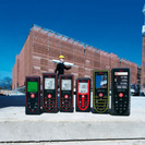
The Leica DISTO™ range of innovative hand-held laser distance meters provides the user with fast and easy distance measurements of length, squares and volumes at the touch of a button. There are eight different laser distance meters available to suit a range of measuring applications.
Other Products
Leica Geosystems product range also includes:
- Automatic optical, digital and electronic levels
- DigiCat i500 and i550 cable locators
- Machine control including digging, grading and paving solutions
- Monitoring software, communication and sensors
- Construction and Industrial theodolites
- Airborne imaging and LIDAR sensors
- Network RTK
Leica Geosystems prides itself on achieving global recognition for the vast range of superior quality, reliable and accurate products and solutions. The expert team of sales and support staff is available to provide comprehensive advice and information across the whole product range. The company is continuously researching and developing the product range to satisfy the ever changing industry requirements and provides solutions to numerous industry sectors throughout the world.


